


London Quarter: delivering accurate data to the commercial property space with the Leica BLK360
Implementation

Published by:
Datasheet
Description
Laser scanning technologies have improved the way measurements are taken and allows businesses to build, upgrade and create new services off the back of their capabilities. Established in 2016, property measurement firm London Quarter has realised significant benefits from the advances of laser scanning and has applied ground-breaking solutions to deliver measurements across many different types of projects, including office, retail, industrial, leisure and residential properties. However, a strong focus on commercial infrastructure paired with a unique approach towards workflows is what's set them apart form competitors in the property measurement space.
EXPLORING THE BENEFITS OF LASER SCANNING
Robert Mayhew, Co-founder and Managing Director of London Quarter and chartered surveyor with 25 years' experience in commercial property valuation, works on providing real estate advice to property owners, investors and lenders. As a former Royal Institution of Chartered Surveyors (RICS) global vice-president and chairman of RICS Europe, he was also a part the RICS Leadership Team between 2012 and 2015. At London Quarter he now oversees the production and delivery of everything from straightforward floor plans, to 3D models of spaces and fly through videos.
"When we first launched the business laser scanning was just another option for measurement services, but it alerted us to the existence and possibilities of devices that were more accurate than we had been using up until that point," says Robert. That's when he and Eddie Yla, Head of Technical Services at London Quarter, discovered the Leica BLK360 imaging laser scanner. At the touch of a button the BLK360 is capable of capturing detailed 360 degree, HDR spherical imagery and accurate point clouds in minutes. "When we purchased the BLK360 there were no other products on the market that compared, it ticket a lot of boxes for us and was perfect for the core work that we do, providing high quality data and precision."
"The accuracy and output you can get from laser scanning, opposed to pad and paper, is extremely advanced," assures Robert. "Additionally, you always have the option of going back and walking through a property with the 360-degree images." Before the BLK360 Robert and his team used to rely on more simplistic devices or even in some circumstances a tape measure to deliver their services - today the laser scanner has become a crucial element of their day to day workflow.
DELIVERING ACCURATE DATA
Working primarily for property consultants, London Quarter focuses on addressing their clients' needs to accurately measure spaces. Developers themselves are also among their core client base as they constantly need to know exactly what architects and contractors have designed and built - as well as possessing powerful marketing assets such as 3D imagery that help them virtually showcase their property to interested parties.
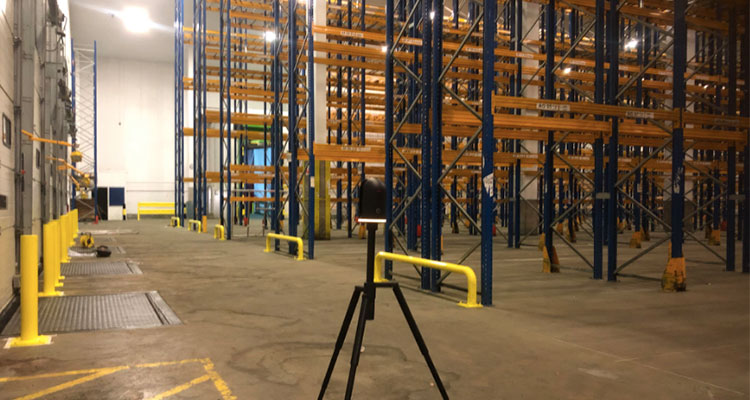
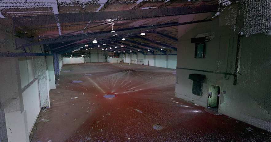
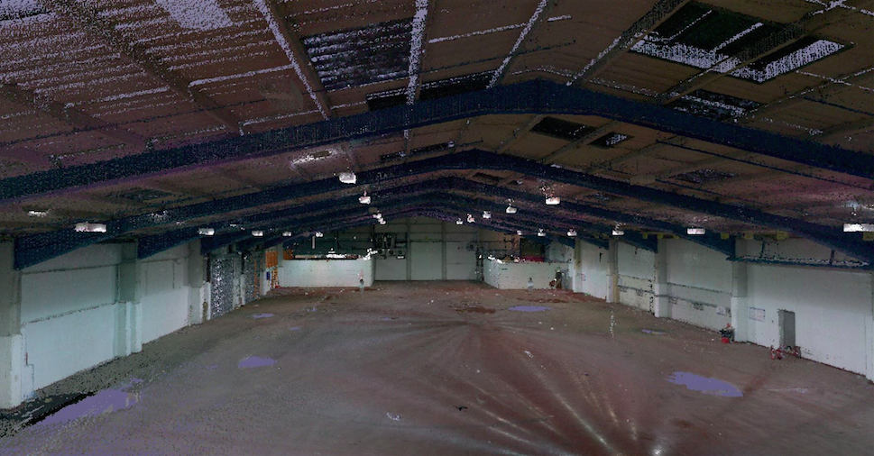
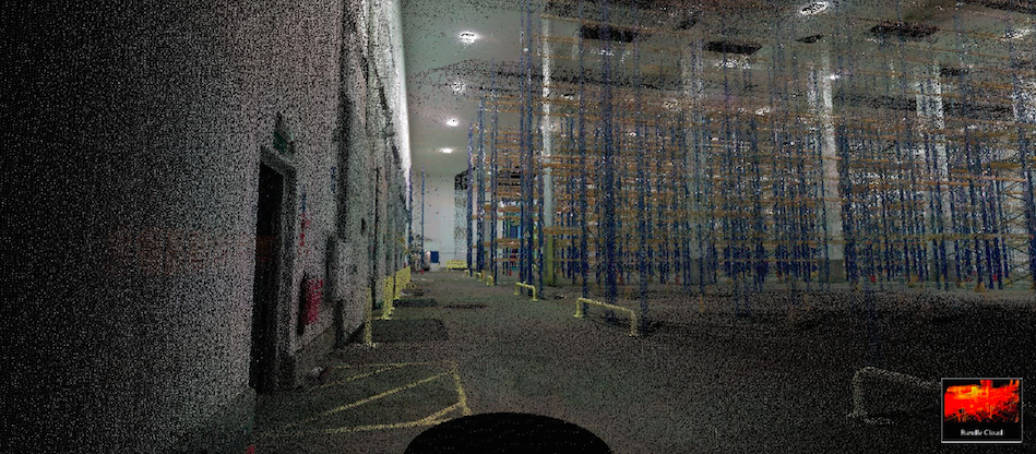
Robert and his team recently worked on a project for BNP Paribas Real Estate, which involved scanning two warehouses in Hoddesdon in order to establish their floor area and also to provide the ability to calculate their volume. The volume of a warehouse, in other words its cubic area, is of key importance for both the occupiers and operators of such buildings. High bay warehouses are frequently an essential requirement for companies and with the use of robotics allowing for increasingly efficient use of warehouse space, it is clear that calculating the area of this property type will be soon based on volume rather than floor area.
The project's onsite work with the BLK360 took one day to complete, with around 200 scans taken during that time. After scanning, the data collected was processed on the Leica Cyclone Register 360 software which allowed to produce the floor plan then delivered to the client in a RICS-compliant area referencing report.
"If we want to be able to compete with the big players and offer something cutting-edge and efficient we needed to get involved with the latest technology," says Robert. "People take floor plans for granted and what we're trying to do is educate our clients that they must not always just rely on what they see in front of them."
Implementation sector
- Topography and digital services