
Capture existing conditions – Important BIM use in the development of a road project

Among the many uses of BIM at Pennstate, “existing conditions modeling” stands out as essential for the planning and preparation of a highway project. What does this term mean? It’s the creation of a three-dimensional model with mapping of the land where the project will be built.
To capture this information in the field, the following methodology options exist: traditional topographic surveying, photogrammetry, or laser scanning. The professional responsible for the project analyzes the most appropriate method for each case, evaluating the scope of the project, the type of terrain, the timeframe, availability, and cost-benefit ratio.
Why is this area so important? Because the mass balance is the first thing evaluated in a basic project, which is the total volume of excavation and compaction required for this project. From there, it’s important to understand whether there is a material balance, the need for material donation/purchase, or landfill. Unfortunately, in initial studies, the characteristics of the materials are not yet known because future geotechnical investigations will be necessary. However, in the project planning phase, mass balance information is essential. Furthermore, it must be taken into account that the earthworks item has a significant impact on the total project cost.
Among the options of the mentioned methodologies, the objective of this text is to address the workflow of photogrammetry:
Step 1: Request authorization from the relevant authorities for drone flight.
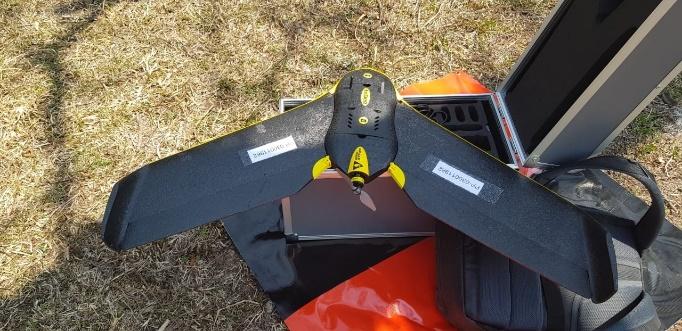
Step 2: Configure the drone via the accompanying app to capture the terrain (flight plan).
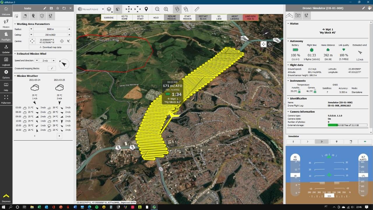
Step 3: The flight is carried out and the photographs are captured
Step 4: These images are transferred to a computer
Step 5: Using specific software, these files are transformed into a mesh or point cloud file, where the data can be further manipulated, edited, and configured. The type of data will depend on the intended use.
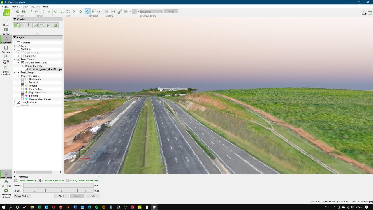
Step 6: This file is imported into the road modeling software, where it can be used to prepare the basic study or project.
It’s worth mentioning that these types of photogrammetry files are large, requiring high-quality computers to perform the task, so adopting this technology requires a significant investment.
The idea here is not to promote one methodology over another, as each case is different, and a combination of technologies may be necessary to meet the demand. Because sometimes not everything can be captured with a particular technology, so a complementary technology is needed.
Regardless of the technology chosen, the more accurate the mapping of the region, the better the quality of the project, resulting in a more cost-effective, efficient project with improved productivity and less risk of rework. Technology is our ally!
Image credits: Rota das Bandeiras Concessionaire and Fernando Pellegrino Martin
Author: Solange Gaspar, Project Engineer | BIM | Road Infrastructure | Innovation. Student of the International Master’s Degree in BIM Management for Infrastructure, Civil Engineering, and GIS at Zigurat.
Source: https://www.e-zigurat.com/blog/en/capture-existing-conditions-bim-use-development-road-project/


