


A New BIM Strategy for Dubai
Collaborative initiative
Published by:
Datasheet
Description
Dubai Municipality and Dubai Building Permit Development Committee launch new strategy for BIM across the emirate
A new strategy for Building Information Modelling that enables a faster and more efficient building permitting system was announced this week at the BIM Middle East and Cityscape Global events. Dubai Municipality, as part of the Dubai Building Permit Development Committee, launched the strategy with the aim of consolidating permitting systems across the committee, standardising regulations against which buildings are validated, and reducing manual code checking and data entry.
A key aspect of the strategy will be enforcing the existing government mandate for consultants to use Building Information Modelling, or BIM, as a process and toolset for planning, design, construction and management of buildings and infrastructure. This mandate has been in place since 2015 but will soon be enforced, together with a new set of BIM standards that will be developed by the committee.
The new standards are planned to be rolled out in 2020.
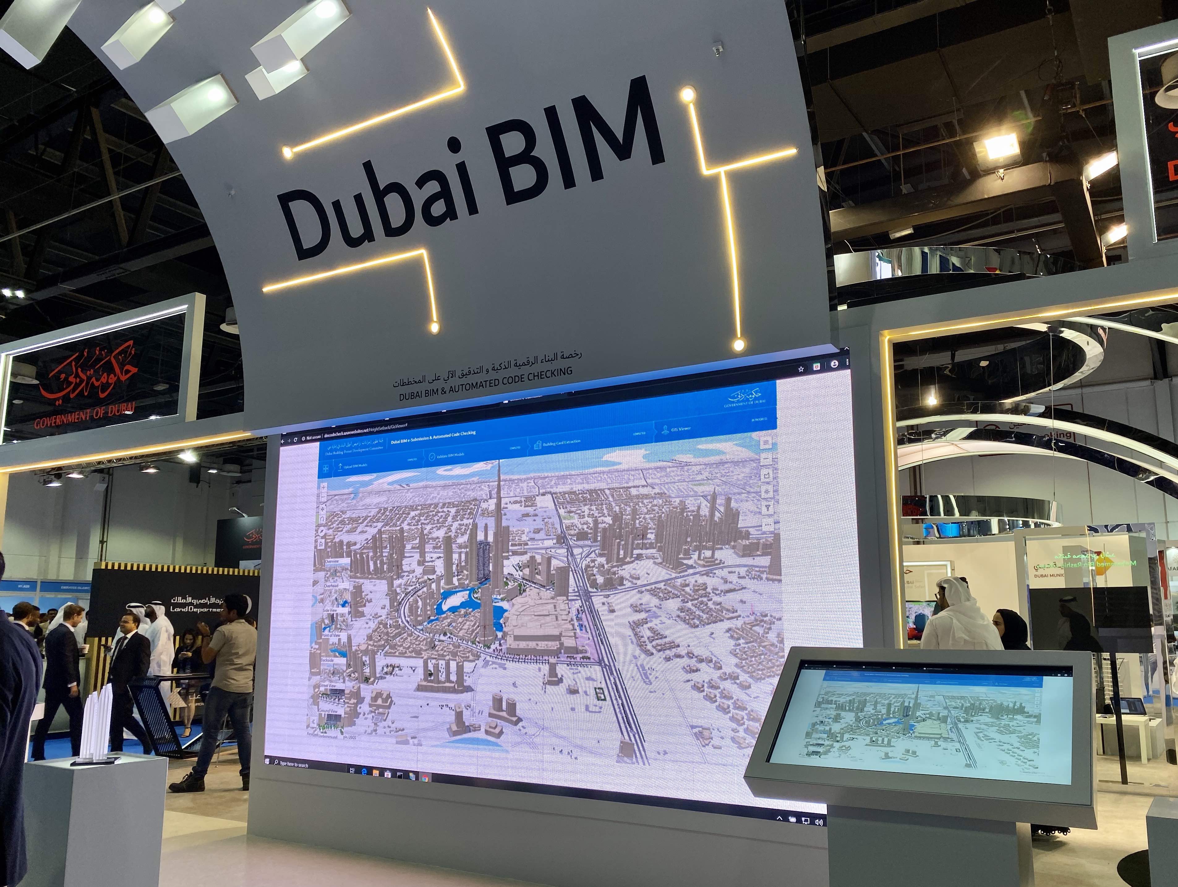
At Cityscape Global in Dubai this week, Dubai Municipality and the committee were showing their newly developed e-submission and automated code checking prototype application. The tool, developed by Esri and partner MasterGraphics.aec, in collaboration with the Dubai Municipality GIS Centre, supports the complete workflow for code checking and permitting:
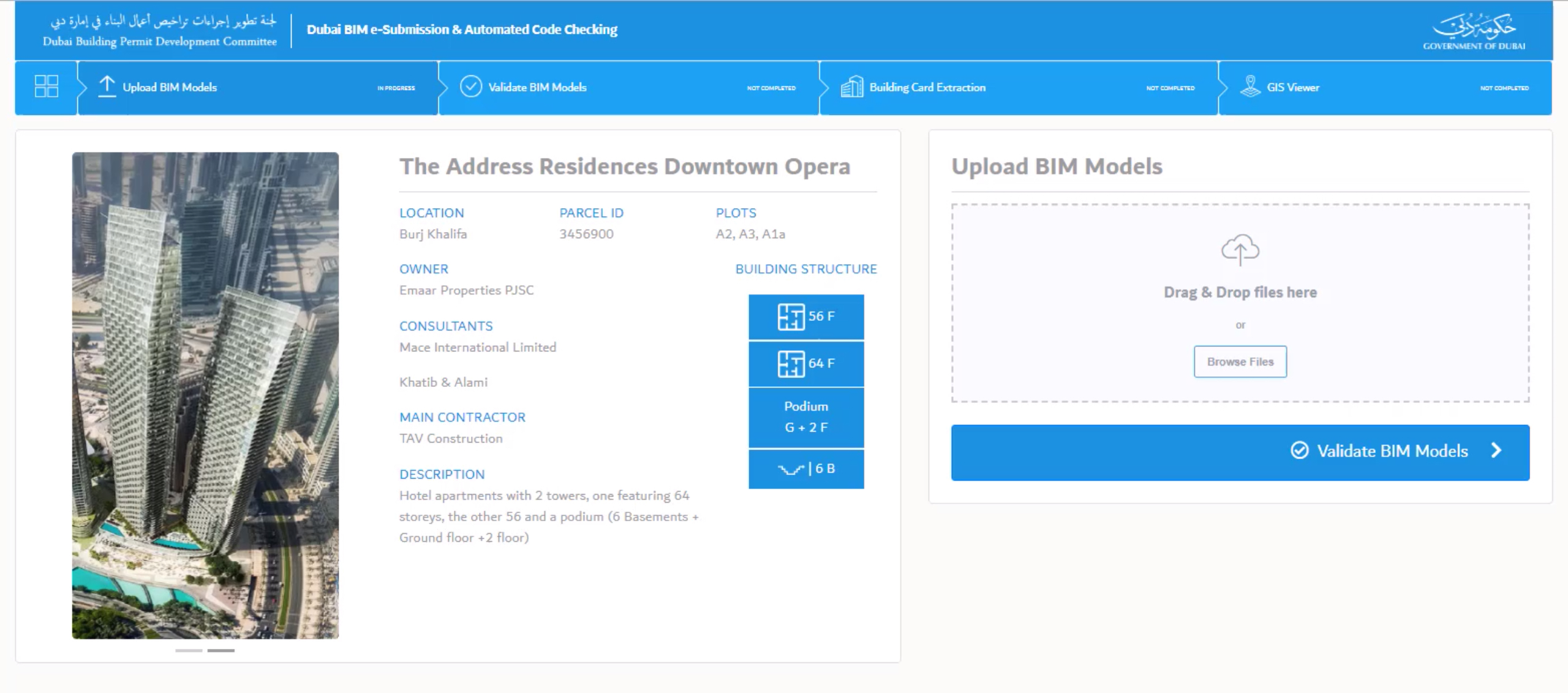
- e-Submission: the consultant can upload BIM model files to the system through a web page.
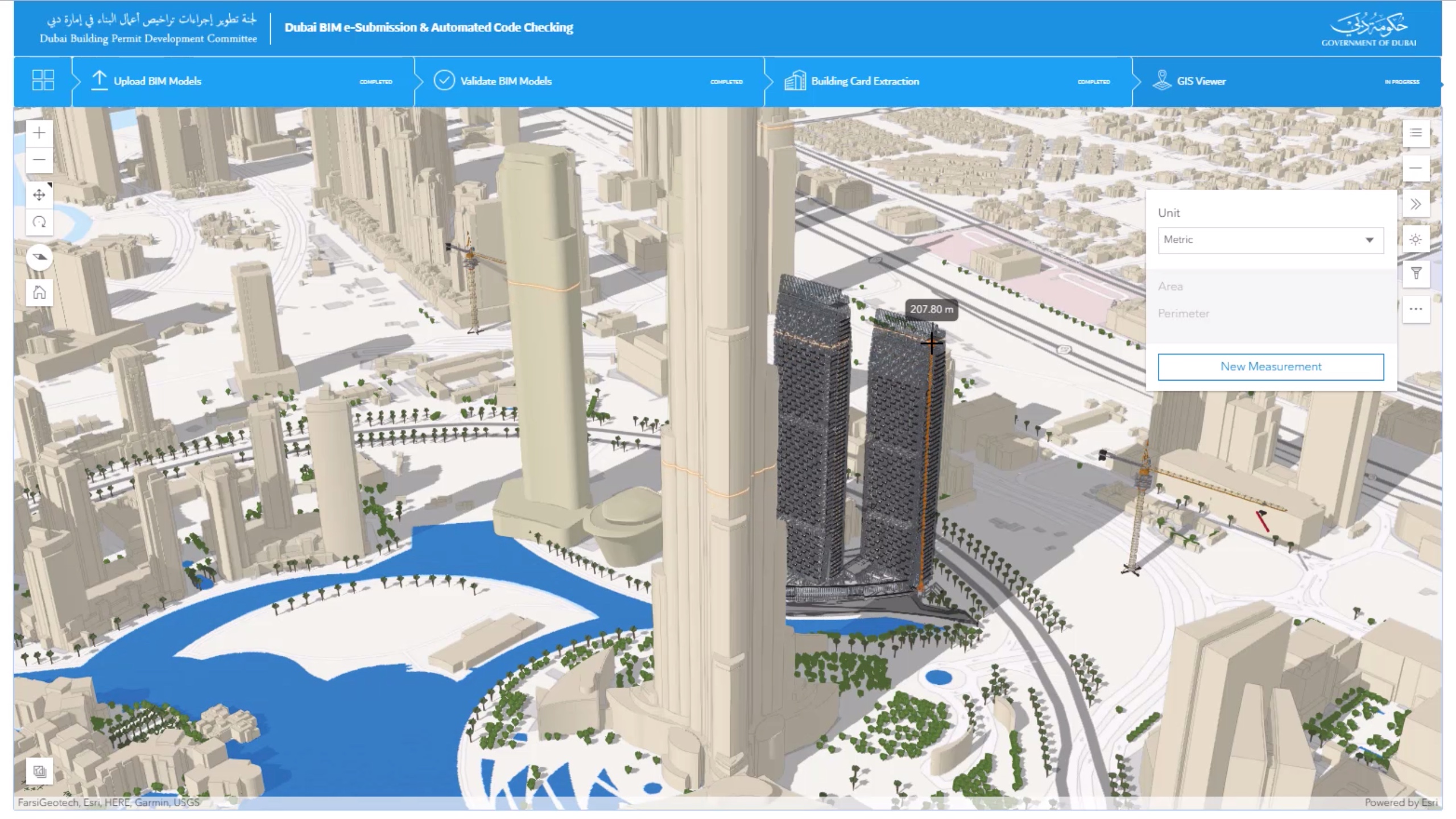
- Validation: the BIM model is automatically validated against the necessary regulations and buildings codes. The system highlights any non-compliance issues directly on a 3D view of the model, enabling consultants to resolve issues before re-uploading the model for validation again.
- Building card extraction: data including numbers of rooms, gross floor area and number of parking spaces is automatically populated into the building card from the BIM model.
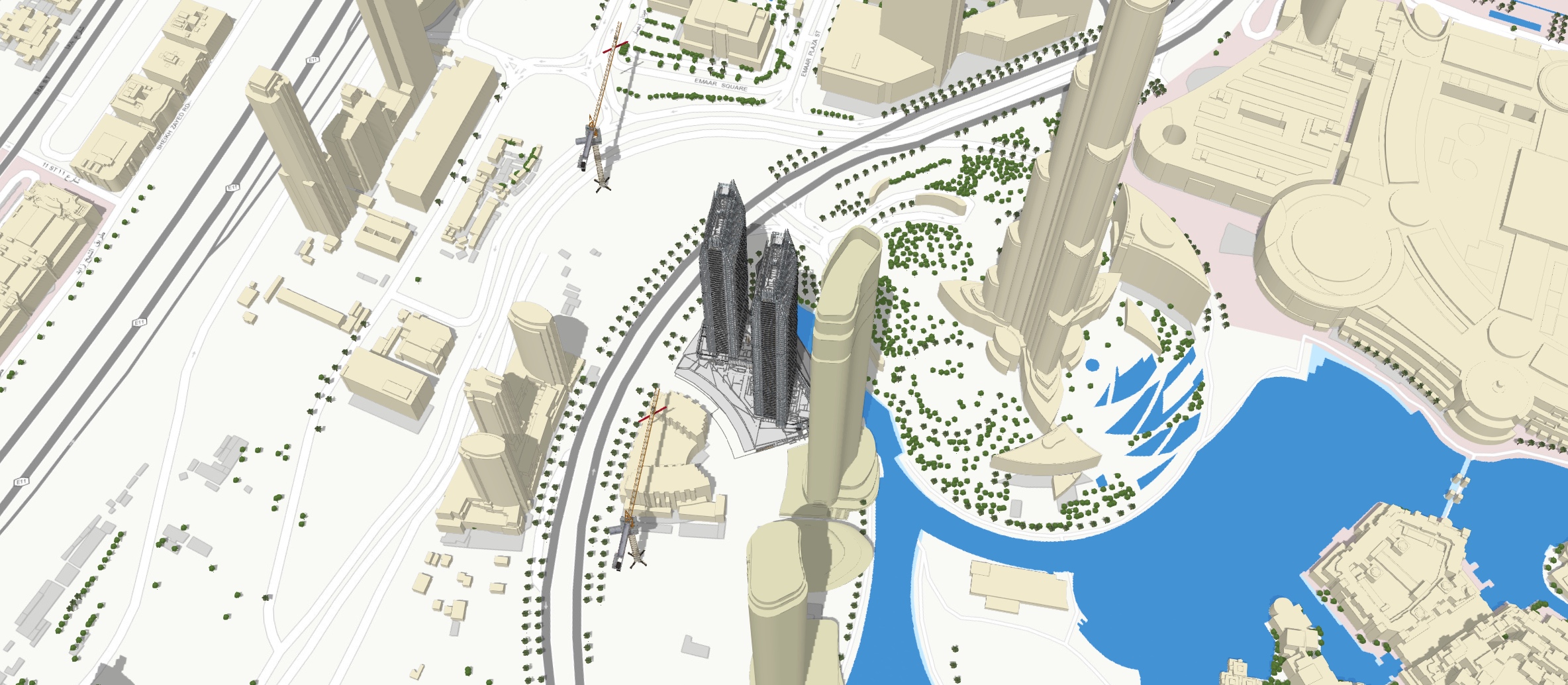
- GIS conversion: the BIM model is converted to GIS layers and visualised in the browser. This GIS data can then be used in downstream processes such as shadow analysis, urban planning workflows, and for sharing city-wide visualisations and planning scenarios with non-technical audiences.
Through the implementation of this new strategy, the committee also hopes to increase the country's World Bank Ease of Doing Business score for dealing with construction permits. The UAE is currently ranked fifth in the world.
Stage of the project
- Conceptual design