


BIM + geospatial interoperability would avoid another CAD and GIS quagmire
The effects of population growth, urbanization and climate change are motivating us to contemplate serious changes in how we build and maintain buildings and infrastructure

Introduction
The effects of population growth, urbanization and climate change have reached the point where we urgently need serious changes in how we build and maintain buildings and infrastructure. This change will require new tools. There are important industry drivers that suggest that AEC and geospatial interoperability is one of them. Traditionally the challenge has been viewed as a culture clash between the AEC and geospatial industries. The way Carl Steinitz puts is that the two segments work at different scales – geospatial scientists deal with the universal, engineers with the very specific. Geospatial folks make maps, engineers and architects make drawings. Engineers and architects use CAD or BIM design tools. Geospatial folks use geospatial tools including GIS.
A specific challenge currently facing the AEC and geospatial industries is integrating building information models (BIM) and geospatial data. This is not the first time these two industries have faced a data interoperability challenge. In the 1990s the challenge facing the two industries was integrating CAD and GIS. Because there was no standards-based solution to this problem, every company has had to find its own solution or acquire a proprietary solution. Over the years the incompatibility between CAD and GIS data structures have cost the utility and telecom industries trillions of dollars in direct and indirect costs. The problem continues to this day for some organizations in these sectors.
There are parallels between what happened in the 1990s in unsuccessfully addressing CAD+GIS interoperability and the current challenge of BIM+geospatial interoperability. But there are also important differences. in the 1990s there were few geospatial or CAD standards (the Open Geospatial Consortium was only founded in 1994), there was no open source geospatial community (the Open Source Geospatial Foundation was only founded in 2006), and major industry players at that time were convinced that pushing proprietary formats was the route to market dominance. There are grounds for optimism that the availability of both BIM and geospatial standards, a vibrant open source geospatial community, and a new willingness on the part of major software players in the BIM and geospatial industries may make it possible to successfully address the latest BIM+geospatial interoperability challenge.
Industry drivers for BIM+geospatial integration
BIM+geospatial integration is being driven important industry trends; sustainable design, full lifecycle BIM, addressing stagnant construction productivity, and smart cities.
McKinsey has argues that the construction industry is ripe for transformation because construction productivity has been stagnant in the world’s leading economies. McKinsey estimates that if construction-sector productivity were to catch up with that of the total economy this would increase the sector’s value-add by about $1.6 trillion which would add 2 percent to the global economy. Digitization by itself is not going to solve the productivity gap in construction but it could be disruptive as it has been in other industries. Two of the key technologies that McKinsey sees as key to transforming the construction industry are geospatial and BIM and to achieve this successfully they cannot continue to operate as silos.
It has become virtually impossible to design sustainable buildings and infrastructure without reference to geographic context. The traditional approach ( often associated with a 0,0 coordinate system ) of design in isolation is no longer adequate when external neighboring structures and vegetation, local high-resolution weather data and solar insolation patterns are essential for optimizing design for sustainability.
Integrated geospatial+BIM is essential during the operations and maintenance phase of a building. A common geospatial coordinate system enables a comprehensive operational view of all infrastructure including internal and external structures including utilities, transportation, emergency planning, first-responder access, energy performance, and evacuation management. BIM+geospatial integration provides greater value to projects, often referred to as design-build-finance-maintain (DBFM) or build-operate-transfer (BOT), that involve not just design and construction but also operations and maintenance. Several years ago private Dutch engineering and construction companies began adopting an integrated geospatial+BIM approach to construction motivated by the design-build-finance-maintain (DBFM) initiative of Rijkswaterstaat, the Dutch highway authority.
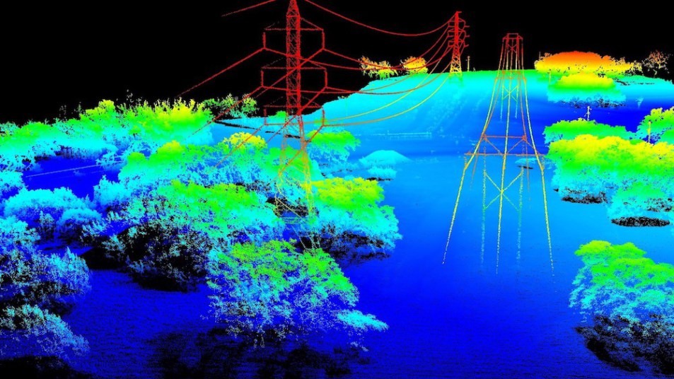
BIM+geospatial integration is also essential to build the digital twins which will be key to the smart cities of the future. The linkage of big data (a lot of it generated by cities), integrating BIM and geospatial, citizen or crowd-sourced science and the internet of things are key to enabling the future smart city. An essential part of the worldwide infrastructure transformation is creating and maintaining precise and reliable digital models that will enable us to operate and manage our new sustainable infrastructure efficiently. Integrating precision engineering data, laser scanned point clouds, and traditional GIS data makes it possible to develop a precise synthetic environment that can be used to simulate the inside (utilities, HVAC systems, furniture, elevators, walls, doors, windows, and structural details), outside (aerial utilities, full city blocks of 3D detail, road access), and under (underground water, wastewater, gas, power, and telecommunications systems) of an urban environment creates an intelligent model that can be used for visualization, analysis, and simulation. For example, urban simulation can be used to analyze the load impact of a new building on a utility network, the extent to which solar heating can be used to reduce emissions, and how much daylight will be available in interior spaces at different times of the day and of the year.
Latest research into BIM+geospatial interoperability from the Netherlands
The Netherlands has led in the development and application of open BIM/geospatial standards in the construction industry including NL/SfB, BS&I, ETIM, CB-NL, IMGeo, CityGML, NLCS, GB-CAS, COINS, IFC, VISI, SALES, National Model BIM Protocol, and National Model BIM Implementation Plan. The Netherlands has created a BIM Loket (BIM Gateway) that is intended to be a national portal for information about BIM and open BIM standards in the Netherlands including related geospatial standards.
At the recent GEO|Design+BIM conference in Amsterdam, Jantien Stoter of the Delft University of Technology and advisor to Geonovum the Dutch geospatial coordinating agency, presented the results of research in the Netherlands to interconvert digital building and infrastructure model standards developed to serve the AEC (architecture, engineering and construction) and geospatial sectors. Specifically, the research was focused on translating the geometry and topology of 3D digital BIM models represented in buildingSmart’s Industry Foundation Classes (IFC) standard into 3D forms compatible with the Open Geospatial Consortium’s CityGML standard. The findings of the research has reemphasized the challenge of interfacing AEC and geospatial data, the first major industrial symptom of which appeared 20 years ago in the form of 2D integration of CAD and GIS.
Work on BIM+geospatial interoperability began in the Netherlands about five years ago. At the Geospatial World Forum in Amsterdam in 2012, Jantien Stoter gave an overview of the ongoing work on the Dutch 3D standard. The Dutch 3D standard integrates CityGML and the Dutch IMGeo standard. CityGML is an Open Geospatial Consortium (OGC) standard for 3D information (geometry and semantics) about buildings and urban transportation infrastructure in cities. IMGeo is the Dutch standard for the exchange of large scale geography such as roads, tunnels, water bodies, land use, and so on. At that time a work group had just started working on aligning CityGML and buildingSmart’s Industry Foundation Classes (IFC) BIM standards. The objective of the work group was to define a standard, semantically meaningful mapping between IFC and CityGML with a focus on geometry and topology. This is an open source project and the source code is available.
What the researchers have found is that BIM models (as represented in the IFC standard form) were full of what would be considered “errors” in a geospatial world. IFC has over 600 classes at last count and it was not clear where the “errors” originated from, but the general conclusion was that there is more than one way to transform a BIM model to CityGML. Furthermore, it was found that while it is possible to transform most BIM models, it is not possible to convert all BIM models to CityGML. Another way to put this is that in general BIM models are not compliant with geospatial rules for topology and geometry. There is a strong parallel with the incompatibilities between CAD and GIS identified two decades earlier.
Clashing tectonic plates: Interfacing CAD and GIS
The BIM+geospatial problem is the latest symptom of a broader problem. I began working in the utility and telecom sector in 1993, specifically in developing software for records management (called network documentation outside of North America), and at that time the magnitude of the AEC+geospatial cultural mismatch problem was just beginning to be appreciated by utilities and telecoms. In utilities and telecoms planners tend to use GIS tools, engineers and designers CAD tools, construction folks in the field paper CAD drawings, and asset managers GIS integrated with their FM tools. Fashioning AEC and geospatial data into an efficient data flow from planning through design and construction to operations and maintenance represented a challenge that remains a problem for utilities. The Between The Poles blog is over ten years old and one of the persistent themes from the very beginning in 2006 was the challenge of integrating CAD and GIS data in a common workflow (some examples; 2006, 2007, 2008).
A workflow that is found at every utility and telecom involves the design-build-maintain information flow. The workflow begins with an engineer and drafter producing a design, typically a CAD drawing, which is printed for the construction contractor to use in building a facility. The contractor uses the drawing in the field and then returns it as an “as-built” to the utility’s records management group, who enter it, traditionally by manually redigitizing it from the paper drawing, into a GIS that is intended to contain the digital twin of the network. The data in the GIS is used for network maintenance, outage management and other functions. The reason for the manual redigitization step is the “errors” that CAD drawings inevitably contain unless drafters are forced to adhere to “geospatial rules”. This entire process is slow and error-prone and backlogs of as-builts waiting to be entered into the GIS stretch into months and even years. The result is that utility GIS data is more often than not incomplete, out-of-date, and unreliable. For example, at the beginning of the broadband revolution, telecoms needed to be able to tell customers whether they were close enough to a terminal and fiber to be eligible for ADSL. In one of the largest telecoms in the U.S. the GIS records were so incomplete and unreliable that survey teams had to be sent out at considerable cost to resurvey the location of their terminals and fiber cables.
Because there was no standards-based solution to the CAD+GIS problem, every utility and telecom has had to try to find its own solution to the problem. This problem has persisted from the 1990s and remains a problem for some utilities – within the last year I heard a presentation by an electric power utility on CAD/GIS integration that wasn’t that different from presentations on the same topic I gave 20 years ago.
Over the years the poor CAD/GIS interoperability has cost the utility and telecom sectors a lot of money. Large telecoms have spent hundreds of millions of dollars trying to cleanup their GIS data and streamline their CAD+GIS workflows. A rough back-of-the-envelope calculation suggests this problem has cost directly and indirectly trillions of dollars over the past 20 years. In addition unreliable and out-of-date network infrastructure data that results from this problem has safety implications.
The juncture between distinct sectors each with its own technologies and business models, AEC (Autodesk, Bentley, and others) and geospatial (ESRI, Hexagon, and others), has analogies with the clash of tectonic plates and the associated incessant seismic events. In the mid-1990s pressure from customers motivated Autodesk and ESRI, 800 lb gorillas in their respective areas of CAD and GIS, to attempt to collaborate to address the CAD+GIS problem. The result of the agreement between Jack Dangermond and Carol Bartz at the time resulted in an unsuccessful product called ArcCAD, which satisfied neither CAD nor GIS users.
Averting a tectonic clash repeat: BIM+geospatial interoperability
The prospect that, by analogy with CAD+GIS problem, we could still be individually finding solutions to BIM/geospatial integration 20 years from now is discouraging. While there are parallels between CAD/GIS and BIM/geospatial, there are grounds for optimism that this time around we may find ways the address the problem in a general way. Firstly, in the mid-1990s there were virtually no geospatial or 3D AEC data standards. The Open Geospatial Consortium (OGC) and builsingSmart were both only founded in 1994. It required quite a while for the OGC geospatial and buildingSmart’s IFC standards to broadly penetrate industry and government. Nowadays, there are many widely adopted geospatial standards; Simple Features for SQL, WMS, WFS, GML, KML, InfraGML, CityGML to name just a few from the OGC. buildingSmart’s IFC standard is supported by all major BIM design tools including the market leader Revit.
Perhaps most significantly there has been significant progress in developing common conceptual models for geospatial and AEC views of city infrastructure. The major breakthrough in bringing the architectural and geospatial views onto a common footing is the OGC LandInfra Conceptual Model developed by the OGC in cooperation with buildingSMART International and approved as an OGC standard in August, 2016. The LandInfra conceptual model was developed by Bentley Systems, Leica Geosystems, Trimble, Australian Government Department of Communications, Autodesk, Vianova Systems AS, and buildingSMART International and provides a unifying basis for land and civil engineering standards including the OGC’s InfraGML and buildingSmart International’s IFC for infrastructure standards. InfraGML is the OGC’s application schema supporting land development and civil engineering infrastructure facilities. InfraGML supports a subset of the existing LandXML standard. buildingSmart International’s IFC-Alignment project uses this common conceptual model of alignments for roads, railways, tunnels and bridges. The objectives of the IFC-Alignment project is to enable the exchange of alignment information through the full infrastructure lifecycle from planning through design and construction to asset management.
Secondly, in the 1990s and the early 2000s there were few open source geospatial projects. The Open Source Geospatial Foundation (OSGEO) was only founded in 2006. Since then there has been rapid development of open source geospatial projects. There is enough open source geospatial code now that at the GEO|Design+BIM conference in Amsterdam, Sanghee Shin, CEO of Gaia3D, described a web-based geo-platform integrating massive, complex BIM models using open source geospatial libraries and tools including PostGIS, GeoServer, and Cesium and NASA WorldWind virtual globes. The importance of this project is that it shows that it is possible using the available open source geospatial APIs and libraries – together with some genuine innovative development – to create an open, non-proprietary 3D geospatial platform for integrating geospatial and BIM. Given the critical importance of addressing the cultural and technical divide between the AEC and geospatial worlds, clearly many believe that a viable open source alternative will be essential for developing the innovative solutions to the challenge of interfacing the two worlds.
Finally, major players in the AEC and geospatial industries, Autodesk and ESRI, have again agreed to collaborate. This time around they are probably more aware of the technical issues hindering BIM+geospatial integration. Both have adopted open standards when it made business sense – often under pressure from government clients – and both have also adopted open source technology where it made business sense. Together the combination of major players supporting the effort, standards organization like the OGC and buildingSmart already working to address the problem, and a broad range of open source code and a vibrant developer community may be enough to address the technical problems. If building and infrastructure owners and facilities managers become aware of the risk of not solving the problem, a solution may be found so that we will not be having the same BIM+geospatial integration discussion 20 years from now.
Source: https://www.geospatialworld.net/article/bim-geospatial-interoperabilty-to-avoid-cad-gis-quagmire/