


Resources | BIM Catalogs Manufacturers
Tools to create successful projects
Chudasama Outsorcing Pvt Ltd.
CAD Drafting Services | BIM Modeling Services - Chudasama Outsourcing https://caddraftingservices.in/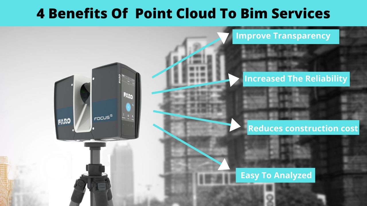
Point cloud to BIM is widely recognized to be more precise than traditional surveys that use measuring tools. We create accurate Models for as-built purposes as well as for the refurbishment and renovation projects. Firstly the Building surveyor surveys the whole existing building with the help of 3D laser Scanner (Faro). 3D laser scanner will give the information of dimensions generating a Point Cloud Model. That is it scans the whole building and generates a .pts file. You can refer image (A) below, which is a point cloud image. Then it is converted into .rcp (ReCAP) file, which is compatible in Revit Software. Then Modelling is created to accomplish the model into the Point Cloud File.
Catalogs
Downloadable File Type
- PCF
Type of product
- Various