


"Favelas 4D", the morphological analysis of Brazil's informal settlements by MIT Senseable City Lab
Project
Published by:
Datasheet
Description
If you know or have heard about Brazil, you will surely also know one of the things that most represent its identity, the Favelas. These precarious or informal settlements are located in the country's large cities and are synonymous with shantytowns or shantytowns.
We can dare to say that their architectural structure lacks logic and that few tools have been used to work on it. In fact, its urban chaos stands in stark contrast to the planned neighbourhoods that surround it, which makes its terrain even more difficult to analyse with more typical open source mapping tools such as satellite imagery.
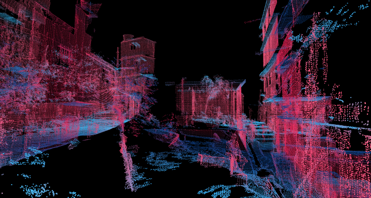
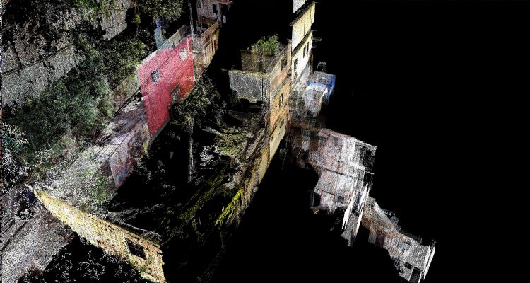
However, MIT Senseable City Lab's "Favelas 4D" project has broken with that paradigm and mapped the largest favela in Rio de Janeiro, Brazil. 3D Laser Scanning with LiDAR (light detection and ranging) is the technology they have used to analyse the morphology of settlements, in this case, the urban landscape of Rocinha, at high resolution and thus, obtain information and understand the urban planning of the area based on these results.
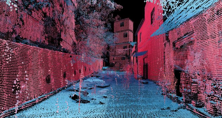
One of the advantages of using this tool is that it uses so-called laser pulses to measure distances and map small points in digital space. Another advantage is its accurate representation of the environment as it can reveal building patterns, illuminating trends in urban development and uncovering actionable information that can inform interventions and policies to improve safety.
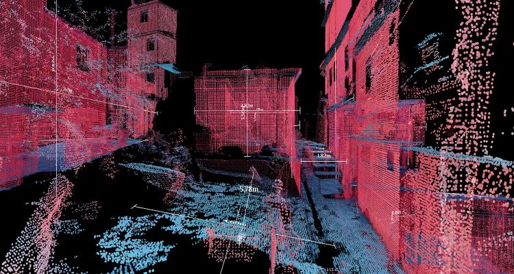
Within the urban analysis two resolutions are operated: one which includes the global analysis focusing on the comparison of different streets; and the other, the local analysis which examines the morphology within the streets themselves where five factors are taken into account: street width, elevation, density, variation in façade height and street canyon.

The urban and infrastructural reality of these sites is that they have been built spontaneously and competitively and that residents live excluded from city infrastructure and services. The MIT team further states: "The global urbanisation trend is not limited to shiny inner-city districts and planned developments: of the approximately 4 billion people living in cities around the world, nearly 1 billion reside in informal settlements built without formal urban planning.
Courtesy of MIT Senseable City Lab
Sources: Senseable City Lab I Archinect I Designboom
Type of Work
- Civil work