


A Walk-through of Point Cloud to BIM Modeling Services
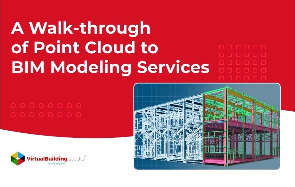
Point Cloud to BIM Modeling

Scan to BIM is the process of 3D laser scanning a physical space to create an accurate digital representation of existing site conditions. The scanned data can be used for designing, analyzing, or evaluating purposes. The AEC professionals are assigned tasks of retrofitting, renovation, conservation, or reconstruction of a building. The Point Cloud to BIM modeling services involve a series of steps followed to craft an actual representation of the site.
A 3D laser scanning device captures the existing site in the form of the scanned data known as ‘points’. The amalgamation of millions of points together formulates a Point Cloud Scan. A point cloud scan is then imported into a 3D modeling platform to develop an as-built model of the site.
The Scan to BIM services serve various purposes like site verification, design validation, comparative analysis, developing as-built drawings, MEP or construction elements demolition or addition, interference checks, quantity take-off, budget estimation, and documentation of existing buildings. The documentation process is inclusive of the following levels
· Floor Plans
· Exterior Elevation & Roof Plans
· Sections
· Site Plan Layout
A walkthrough of the process of Point Cloud to BIM Modeling Services
The step-by-step process involved in the Execution of a Scan to BIM project has four different stages that are executed as per the BIM execution plan and as per project workflow.
Capture
The company can gather as much information as possible from the field and the client about the project. The scope of work, the level of detail timeline, and the deadline of the project can be determined.
The descriptive scope of work defines the inclusion and exclusion of all trades. The documentation of information takes place in two phases:
Pre-mobilization considerations
This phase takes into consideration all information regarding the scanner selection and elucidates the site work plan before the site work starts.
The laser scanners used in the process have specific advantages and drawbacks. Hence, it is crucial to do the cost and comparative analysis of all scanners to choose the one that is deemed to fit with project requirements.
On-site information
The scope of work is defined after proper invigilation of the site before work commencement. A standard template worksheet can be created to document a thorough analysis of the site, ensuring the desired quality of the end product. The skills of the employed team should align with the project requirements and existing site conditions.
The process involves placing the scanner on a tripod capturing the building with high speed and utmost precision. The device includes an eye-safe rotating laser at a high speed. The laser is positioned at the tripod and as the beam hits any surface it records its positions as coordinates referred to as ‘Points’.
Process
The next step after documenting the as-built site conditions is to process the scan. This step includes validating the survey data regardless of its accuracy.
The inspections carried out check the interruptions in the fluidity of the data. Environmental vibration can be the cause of fluidity of data and it may not be captured by internal system checks.
To process the scanned data further, it is crucial to bifurcate the datasets into small clusters and develop an extra copy of data before doing manipulations.
The next step is the data registration and alignment. Different applications like best fit, ortho, geo-referencing, and many others, require different techniques to align the data.
The team should manually check the scan data to eliminate the possibility of errors or any kind of overlapping. The initial process of registering and loading the point cloud scan completely is important to avoid difficult-to-correct elements.
BIM Modeling
It is the stage where all documentation and scanning are transformed into a real-life scan of the project in a digital platform. Several steps are followed to execute the Scan to BIM services and create models from the Point Cloud scan.
Verification
The scope of work with included and excluded trades, Level of detail requirements by the client, and other necessary details should be communicated before initiating the modeling process.
The commencement of the modeling process requires the verification of point cloud coordinates. Some widely used software are Building Scan to BIM, Point Sense, Edgewise, and Leica CloudWorx.
Insertion
After completion of the verification process, the point cloud is inserted into Revit. In the case of multiple-point cloud files, it is crucial to examine the coordinates and integrity of all files simultaneously. After the file is inserted in Revit, it is locked to a specific location using the Pin tool.
File set-up
To initiate the file set up in Revit, worksets are created as per project requirements. Each point cloud should use different worksets to set the VVGG setting. Levels such as Level 0 through the origin, building level, plan view, and others can be set from a locked section view.
Modeling
The BIM execution plan should follow certain guidelines for modeling purposes. Every element of the project should be modeled as a single correct Revit element and instead of using a generic model with ‘#’ of extrusions, a group of single columns should be utilized. The walls of the models can cut thin view angels in plan and section views to properly align with the Point Cloud.
Collaboration
The Point Cloud to BIM Modeling services involve clear and proper sharing of all the necessary information between the project team. The storage disc of the Point Cloud should be accessible to all team members for working or reference purposes.
Quality Assurance
The process of ensuring the model quality is a crucial step in Point Cloud to BIM Modeling services. There are a few QC process steps to be followed after modeling. By throwing a section and moving it across the project, a quick round of model checks is executed with visibility and override options checking specific elements.
Autodesk’s Navisworks is used to check clashes between the Mechanical, Plumbing, and Electrical disciplines. This software provides an easier way to maneuver through the Revit model. The file should be properly cleaned by deleting all reference points and detailed lines from the model.
Conclusion
The Scan to BIM Services entails a process of digitally presenting the actual on-site conditions of the building with its physical and functional traits using Point Cloud to BIM Modeling.
An accurate 3D scan of the site is captured using a laser scanner and then transferred to BIM software for creating as-built models with four major steps, as discussed above.
Source: https://www.virtualbuildingstudio.com/point-cloud-to-bim-modeling-process/