


Converting Point Cloud Data to 3D Revit Model – Challenges and Solutions
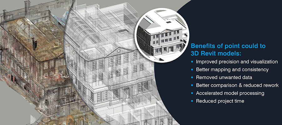

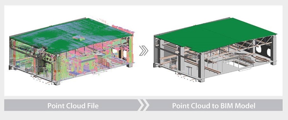
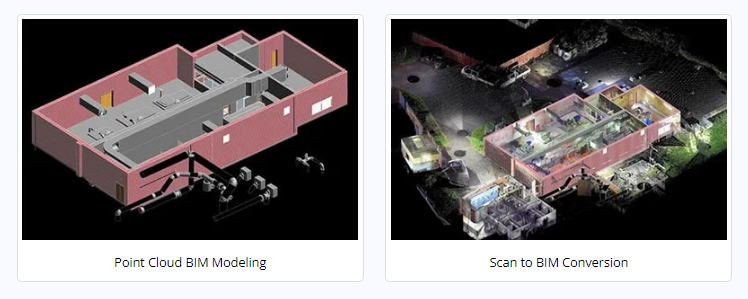
Conversion of point cloud data to Revit 3D models addresses key issues of as-built inconsistencies and data errors in renovation and retrofit projects. Large spatial datasets can easily be processed for greater mapping precision and better 3D visualization.
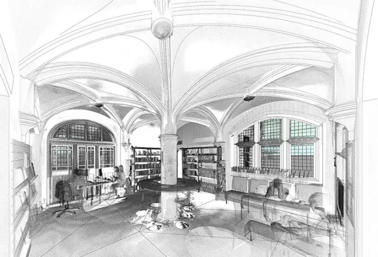
Point clouds capture the minutest details of heritage buildings, allowing re-creation of structures and architecture, even if documentation is lacking. Documenting current conditions of a structure and generating spatial models from point clouds sets the foundation for effective decision-making. This, in turn, saves project time and costs. Point cloud to BIM modeling serves as a tool to digitally document and preserve the structure’s “DNA”. The data can also be integrated with AEC applications to assist construction professionals. This provides higher interoperability and real-time information with BIM models.
Generation of a 3D model is guided by the concerned structural and architectural complexities and their accompanying features. Renovations or heritage-BIM add various layers of complexities and intricacies that require each object to be identified and differentiated from the rest. Barriers or challenges are common to any complex project; however, renovation or restoration throws in an added layer of challenges in converting point clouds to Revit 3D models. These challenges include inconsistent or missing information, inaccurate interpretation of scanned data of complex geometry, and various other barriers.
Point cloud to BIM modeling addresses these challenges. Detailed point clouds for 3D models with the right Revit workflows lead to time and cost savings and enhanced ROI.
Challenges in converting point clouds to Revit models
- Setting an irrational coordinate system can lead to undesirable graphical practices and incorrect point cloud display in Revit
- Inaccurate point cloud alignment or registration issues can lead to mapping errors in point cloud transformation
- Unwanted scans or details create unwanted data and bigger file sizes, resulting in inaccurate 3D models and rework
- Incomplete or imprecise scan data prompts 3D modeling ambiguities and result in greater RFIs, rework and time and cost overages
- Large multiple scans are data-heavy, and can have higher storage needs and slower processing of the Revit 3D model
- Inaccurate orientation of the scans to the Revit coordinate system result in greater modeling challenges, and increased project time
How to convert point cloud to Revit 3D model efficiently
Using a rational coordinate system reinforced with a base point improves 3D model precision and visualization
The input files in the form of scans and point cloud data need to be reviewed. Coordination issues need to be resolved. This is done by inserting the coordinate’s equivalent to the scans to fix the orientation and new position of the point cloud. Setting the base point through shared coordinates and moving the base point closer to the project coordinates can help ease work in the original coordinate system.
A rational coordinate system can support the modeling team to achieve desirable graphical behaviors and accurate point cloud displays in Revit. Advanced processes and tools can be used to leverage quick point cloud visualization, extract measurements and gain query point cloud coordinates.
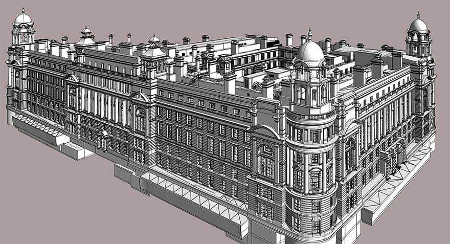
A laser scanning services provider from the UK approached Hitech BIM Services for Scan-to-BIM conversion of a monument building. With 3D survey measurements and survey images, the team at Hitech BIM Services built a Scan-to-BIM model at LOD 400 using Revit. With the following deliverables in place, the client was able to leverage a digitized version of the heritage building with 3D visualization, which led to greater insights for:
- Material quantity
- Workforce costs
- Precise renovation timelines
Accurate point cloud alignment or registration helps better mapping and consistent point cloud transformation
To get an accurate point cloud, multiple points need to be collected appropriately for scan integration. Understanding the orientation of the scanned object in its local coordinate system is critical. Matching the standard point cloud in the dataset with the scanned point cloud reduces alignment and registration issues. This results in improved analysis.
Extrapolating each point helps retain the direction and density of the point clouds for rotational alignment. Once the rotational alignment is complete, horizontal and vertical alignments can be performed. Accurate point cloud alignment in various stages accelerates outcomes by 20% depending on the point cloud dataset. This removes manual intervention and improves workflows for any type of 3D model creation. Major issues that require expert opinions are resolved through the creation of RFIs for client feedback.
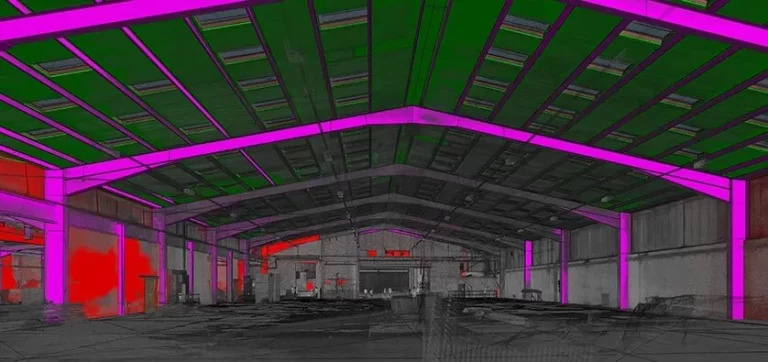
Unwanted data removal from scanned data improves 3D model performance
3D point clouds obtained from laser scanners are cluttered with unwanted object data. Cleaning this noise in the geometry processing workflows reveals the actual scanned areas. Based on the source, internal and external noise or unwanted data can be cleaned up.
Denoising the point cloud in Recap and exporting the scan in Revit preserves the actual features of the scanned data, prevents input degradation, and facilitates accurate surface optimization.
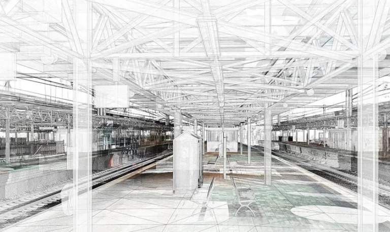
Comparison of scanned datasets with photos and drawings improves as-built consistency, lowers RFIs, and reduces rework
Missing or imprecisely scanned data needs to be compared with normal or 360-degree photos or 2D drawings of the proposed location to create an accurate Revit model. Comparing drawings and Revit models with scanned data can be used to create expose elevation views in the as-built point cloud.
Pre-emptive error resolution cancels out the schedule and budget overruns in the preconstruction stage, leading to diminished RFIs. Enhanced fidelity and improved manipulation can be achieved through an integrated model concept.
A topographic services company from Tarragona, Europe approached Hitech BIM Services for point cloud to BIM conversion of a commercial building. With point cloud files provided as input, an accurate structural model with basic architecture requirements or 3D CAD output had to be exported from Revit.
The team at Hitech BIM Services built a 3D model exported from Revit for a total surface area of 111,000 m2. The point cloud to BIM deliverables saved construction time and helped the client achieve accurate load calculations for a new building design.
Avoidance of large point cloud datasets speeds up model processing
Avoiding large datasets, using the required data points, and denoising the point cloud before importing it in Revit improves model processing speed. Using powerful point cloud tools like Revit for BIM, workstations are used to handle large point cloud datasets with full density real-time modeling. Placing point cloud file groups on worksets in Revit enhances file handling capabilities through visibility and graphical overrides.
This improves the productivity of design reviews by up to 20%. Breaking a dataset into clusters and keeping a copy of it is a safer way to manipulate scanned data. Setting up a control model for grids, levels, and coordinates, etc. helps speed up collaboration to share or modify Revit models in real time.
Resolution of building orientation improves model accuracy & reduces project time
Resolving orientation issues can be achieved through the use of accurate locations from Google Maps and changing the building orientation based on true north. It becomes easier to identify topographic components with the use of Google Earth for identification and review. One can also create and identify project libraries for components like doors, windows, etc. and save time and promote 3D model consistency.
A building construction company from the UK approached Hitech BIM Services. With a need for Scan to BIM modeling of the institute’s mechanical backyard, the client provided images and files as input. The team at Hitech BIM Services built a coordinated and clash-free BIM model with the relevant architectural and structural requirements. This led to informed decision-making for the client, reinforced with diminished risks and cost and time reduction.
Point cloud and 3D models – A new era in building restoration
Techniques to convert point clouds with application-specific software may often be costly and include manual involvement. Handling large data volumes can be complicated, thus big point cloud information must be more efficient to ease decision making and data extraction. Manual processing and unviable collaboration need to be replaced with project-wide automation and data organization.
Spatial references are the closest deliverables to actual reality that need to be optimized for quick decision-making based on digital realities. Archiving point cloud data can lead to very high storage requirements, output incompatibilities, and complex collaboration. Interoperable scenarios need to be put in place through which a single point cloud can be viewed by multiple users from various disciplines, each having separate requirements.
Conclusion
Point cloud to BIM is the most efficient method for digitizing and documenting existing conditions of building and infrastructure with reduced cost and turnaround time. Converting point cloud to Revit 3D models will move beyond the norm and one would be able to tailor scan-to-BIM algorithms as per project needs to overcome various challenges.
With the rise in technology development, it’s just a matter of time before the construction industry begins using point clouds to their full potential. AEC companies are increasingly outsourcing their point cloud modeling needs to trusted BIM partners for flexibility and scalability and quicker turnaround times.
Source: https://www.hitechbimservices.com/blog/convert-point-cloud-data-to-3d-revit-model.php